
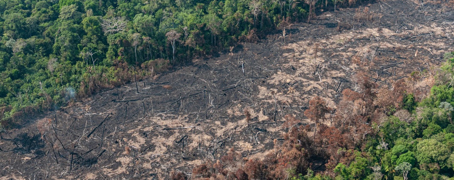
Imazon estimates a threat to 6,500 km² of the Amazon in 2025
16 de January de 2025
By Ana Cláudia Leocádio – From Cenarium
BRASÍLIA (DF) – The Artificial Intelligence platform developed by the Imazon Institute (PrevisIA) estimates that 6,531 km² of Amazon rainforest is at risk of deforestation in 2025, covering the period from August 2024 to July this year. The states of Pará, Amazonas, and Mato Grosso have been identified as the regions with the largest areas under threat.
According to data from the Monitoring Program of Deforestation in the Legal Amazon by Satellite (Prodes), a system by the National Institute for Space Research (Inpe), 6,288 km² of forest were lost in the Amazon between August 2023 and July 2024, a 31% decrease compared to the previous period. If Imazon’s estimate for 2025 is confirmed, the loss will be 4% higher than in the current cycle.
The organization stated that the platform has been identifying threatened areas in the region since 2021, with an average accuracy of 73% over the past four years.

According to PrevisIA, the State of Pará has 35% of its forest areas under threat, followed by Amazonas with 20% and Mato Grosso with 17%. These three states account for 72% of the total threatened territory. Acre has 10% of its areas at risk, Rondônia (8%), Roraima (5%), Maranhão (3%), while Amapá and Tocantins each have 1%.
Despite the high index, the Imazon tool estimates that Pará will reduce deforestation in 2025 compared to 2024. In Pará, deforestation is predicted to decrease from 2,362 km² last year to 2,287 km² this year. Mato Grosso’s deforestation is expected to drop from 1,264 km² in 2024 to 1,115 km².
Amazonas, on the other hand, is expected to see an increase in deforested areas in 2025, with the projection rising from 1,143 km² in 2024 to 1,300 km². Acre (from 448 km² to 684 km²) and Rondônia (from 325 km² to 548 km²) also show an upward trend according to PrevisIA’s projections.
Imazon researcher and PrevisIA coordinator, Carlos Souza Jr., emphasizes the need for action to protect areas identified by the platform as being at very high, high, or moderate risk of deforestation to further reduce forest loss in the Amazon and make progress toward the goal of zero deforestation by 2030.

“Reducing deforestation is essential to lower greenhouse gas emissions in Brazil and mitigate the effects of climate change, which are already seriously impacting us, such as floods in Rio Grande do Sul and droughts in the Amazon. We need to use this technology in favor of the forest“, the researcher stated.
Imazon explains that one of the variables used by PrevisIA’s model is historical deforestation data detected by Prodes, which makes the platform’s forecast “conservative.” This is because, in 2024, there was a significant increase in deforestation and fires starting in August, one month after Prodes’s calendar cutoff, and these data were not included in the risk model for 2025.
“According to Imazon’s Deforestation Alert System (SAD), from August to October 2024—months included in Prodes’s 2025 calendar—1,628 km² of forest have already been lost, 25% of the forecast. This means that preventive actions will need to be intensified, especially from May onwards, when the rainy season in the Amazon ends, making deforestation easier“, Souza Jr. explained.
PrevisIA is a platform that uses artificial intelligence to identify areas at risk of deforestation in the Amazon. It was launched in 2021 by Imazon in partnership with Microsoft and Fundo Vale. “The methodology analyzes a set of variables such as the presence of legal and illegal roads, prior deforestation, land classifications, distance from protected areas, rivers, topography, urban infrastructure, and socioeconomic information“, Imazon clarified.
Indigenous Territories Under Greater Threat
Ten Indigenous Territories (TIs) have been identified as being at the highest risk of deforestation in 2025, six of which are in Pará, three in Amazonas, and the rest in Mato Grosso, Roraima, and Maranhão. Mato Grosso shares the Parque do Xingu IT with Pará, and Amazonas shares the Yanomami IT with Roraima.
The Kayapó TI in Pará tops the list as the most threatened, with an area of 25.43 km², equivalent to 2,500 football fields at risk of being cleared, according to Imazon. The Apyterewa IT, also in Pará, follows with 24.82 km² under threat. This territory led the 2024 forecast and was the target of federal action against illegal occupation, which may have contributed to the drop in projections for 2025.

The ITof Alto Xingu (MT/PA) and Alto Rio Negro (AM) each have over 13 km² threatened by deforestation in 2025, according to PrevisIA. Other threatened Indigenous territories include Cachoeira Seca (PA), Yanomami (RR/AM), Munduruku (PA), which is also undergoing eviction processes, Araribóia (MA), Trincheira Bacajá (PA), and Vale do Javari (AM).
Conservation Units
Of the ten Conservation Units (CUs) most at risk of deforestation in 2025, six are state-level, three are federal, and one is municipal. The Triunfo do Xingu Environmental Protection Area (APA), managed by the State of Pará, tops the list for the second consecutive year, with 95.03 km² at risk—nearly 10,000 football fields.
In second place is the Chico Mendes Extractive Reserve in Acre, with 71.55 km² at risk of deforestation, followed by the Tapajós APA (PA) with 50.18 km². Other CUs under threat include the Soldado da Borracha Ecological Station (RO), Jamanxim National Forest (PA), Marajó Archipelago APA (PA), Jaci-Paraná Extractive Reserve (RO), Paru State Forest (PA), Lago de Tucuruí APA (PA), and Tapuruquara APA (AM), which is under municipal responsibility.